

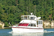
We were treated to the sight of one beautiful lady as we
started upriver; the spectacular “S.S
Sophie”, a beautiful 80’ wooden yacht built by John Trumpy and Sons in
1947. http://www.powerandmotoryacht.com/other/greta-van-susterens-trumpy
If you are of a certain ago (our age for
example) you may think that she looks vaguely familiar. If so you may be remembering another Trumpy
yacht, the legendary presidential yacht “Sequoia”, used by Presidents from
Hoover to Carter. http://en.wikipedia.org/wiki/USS_Sequoia_(presidential_yacht)
In fact we shared the first lock of this journey with the
Sophie and another 90’ yacht. There are
a total of 5 locks on the Okeechobee Waterway between Ft. Myers and
Stuart. The first three are on the west
side of the lake and lock boats up to the level of the lake, the final two are
on the east side and they lower boats to the level of the Atlantic on the east
coast. The locks on this system are
unlike any others we have been through in the U.S. or the Canadian Trent-Severn
Canal in that they are not filled or drained by the opening or closing of
valves but by a much simpler method.
When the boats are in the lock chamber and the gates are closed on both
ends they simply open the gates on the high end a bit to allow water to flood
into the chamber and raise it. How fast the water cascades in depends on how
much the lockmaster opens the gates, sometimes it makes for a bouncy ride
up! If they are lowering the boats they
simply open the gate on the low end and allow the extra water to flow out until
the depth is equalized.
We traveled 55 miles and locked through 2 locks between Ft.
Myers to the small town of Moore Haven and tied to the city dock for the
night. Like many small towns in rural
America this one is down on its luck, recently even the grocery store closed
and now they have to make do with a Dollar General or drive the 16 miles to the
town of Clewiston.
When we arrived in Moore Haven we knew that rain and
thunderstorms were almost a certainty the next day and so we had planned to
spend a day relaxing since we (read Theresa) don’t like to travel in the rain. The
rain was ahead of a cold front, the wind came after the front passed and since
Lake Okeechobee is a large body of water we decided to sit out the wind event
as well, especially when NOAA called Small Craft Warnings for Lake O. All was not lost, I used the time in Moore
Haven to finish the taxes and put that task behind us for another year.
After two days in a one day town we were more than
ready to be moving again, so at 7:30 we were in the Moore Haven lock and
locking up to the level of the lake, then down a 15 mile canal to the town of
Clewiston and out into Lake O. http://en.wikipedia.org/wiki/Lake_Okeechobee

We have crossed the lake before in 2007 and at that time the
water level was near a historic low and it was a nail-biter as we started out
the channel knowing we had only about 15” of water (sometimes a bit less) under our exposed
props. This time the water levels were
nearly normal and we enjoyed a cushion of about 3’ under us! At over 700 square miles Okeechobee is a big
lake, in fact it is the second largest lake contained entirely within the lower
48 United States (Michigan is larger, of course). With an average depth
of only 9 feet it is also very shallow for a body of water this large and the waves
can build fairly quickly, which is one reason we wanted to get an early start
before the winds built for the day. In fact much of this lake is less than 3 feet deep, and it is balanced by the 12' areas, so it isn't suitable for exploring in a boat like ours.
Once upon a time
Okeechobee was well know as a destination bass fishing lake, and hosted many
tournaments. It was often featured on
television with the well known Bassmaster, Roland Martin. Even with all that
going for it Okeechobee is not a very pretty lake, the water is brown and yucky
looking, and because it is so large a boat crossing the lake is not able to see
the shoreline except as a distant horizon.
In short we don’t find it a place to linger.
It is 25 miles across the lake taking the most direct route
available, about 3 hours at our speed, and by about noon we were entering Port
Mayaca lock on the east side of the lake.
It was a beautiful day to be on the water and aside from the wakes of
the faster boats passing us we had a great ride across. The best part of the trip came when we were
approaching Mayaca Lock. We called to
ask for a lock opening and the lockmaster asked our position, when informed we
were about 15 minutes out he said “captain I don’t know if you’re going to make
it, we have divers here and we have to get them back in the water. How far out are you again?” Larry advised him that we could speed up and
make it in 10 minutes. The response came
back, “well, I’ll see how soon this westbound gets here”. With that we pushed our throttles up and met
the westbound coming out of the lock.
Needless to say we thanked him profusely for holding for us. We heard him tell the boat 30 minutes behind
us that it would be about 3 hours before the lock was back in service. Luck was with us because our only other
option would have been to put out an anchor and wait!
From Port Mayaca lock it is 40 miles (and one more lock) up
the St. Lucie canal and river to the Atlantic Intercoastal Waterway. It was our intent to anchor in a creek a few
miles before we came into Stuart, unfortunately the creek and the wind had
other ideas and we were not satisfied with the anchoring situation - mostly due to the direction of the wind. So after a couple of attempts we decided to
move on. A phone call to the mooring
field in Stuart yielded the information that they were “full up”. Being a bit frugal we were not excited to plunk
down $2/ft, plus an electric charge for the privilege of tying to a dock for
12-15 hours so we scouted for an anchorage and Active Captain, an online
crowd-sourced guidebook, pointed us to a great spot that afforded us plenty of
swinging room and protection from the east winds; not to mention a great view
of some of Stuart’s finest homes.
In all we had traveled 130 miles, 75 of it one day, and we
were on the “other side”! Funny thing - the sunsets are about the same over here.

Beautiful home seen from our anchorage in Stuart.
 |
| Sunset on the "Other Side" |
No comments:
Post a Comment