Friday, August 7, 2009

The Tale of the Snail Darter

Oh my goodness I think we have arrived at one of, if not the, the most beautiful places we have visited so far. I know I have rambled on about the Tennessee but now we are up in the final 50 or so miles of the river and decided to take a side trip up the Little Tennessee River to the Tellico River also known as Tellico Lake. To borrow a term from the texting folks OMG it is spectacular here in the shadow of the Blue Ridge Mountains. Every turn is a new “oooh or aaah”, sort of like when you are watching fireworks. The water is clear and, generally, deep which gives it gorgeous blue-green color.


Don’t think that all this beauty has caused me to abandon the pursuit of a history lesson, for the valley of the Little Tennessee is rich in history and I’m going to share some of its most recent story. The story of the construction of Tellico Lake covers a period of nearly 40 years, from before World War II until 1980.

Back in the late 1930’s the TVA built Fort Loudon Dam about 50 miles below Knoxville for the purposes of flood control and hydro-electric generation. Today we take electricity for granted and it is easy to forget how important the power generation was back then but remember that there were many rural areas that still did not have electricity on the eve of WWII. For balance it is also good to keep in mind that the TVA was, and still is a governmental type bureaucracy and was eager to build themselves an empire. Anyway shortly after Ft. Loudon Dam was completed the TVA proposed to create more storage space for flood control while at the same time providing more water for electric power generation. They could do this by constructing a dam on the Little Tennessee just above its mouth (which was about a mile below the Ft. Loudon Dam) and cutting a canal to connect the reservoir formed by that dam with the reservoir above the Ft. Loudon Dam. This project was referred to as the Ft. Loudon Extension and in 1942 was projected to cost $10.7 million. Funds were appropriated in June of 1942 but within a few months the TVA was told that the project must be postponed because of WWII.

It was 1963 before a new and improved (read “larger”) version of the project was revived, this time with a new name; the Tellico Project. The world was quite different in 1963 than it had been in the 40’s and as you might expect there was a great deal of controversy surrounding the Tellico Project. Proponents focused on the economic benefits, jobs, and growth potential. Opponents sited the loss of a free flowing river, loss of agricultural lands and the historic value of the land to the Cherokee Indian Culture (even though the Cherokee had been forced from this land in the 1800’s and relocated to Oklahoma). Congress ultimately appropriated $41 million dollars and construction on the project began in 1967.

In 1969 Congress enacted the National Environmental Policy Act. In 1971 the TVA was ordered to stop work on the project because the environmental impact studies required by the 1969 legislation were apparently more rigorous than those that had been completed when the project was approved and they were accused of proceeding with inadequate studies. It was 1973 before the courts ruled that the statements on file were acceptable and the project could continue.

OK friends it is time to get those neurons firing; check those cranial files for the term “snail darter”. Does it sort of ring a bell, but you just can’t place it? Yeah me too, but now I have the scoop. Sometime in 1971 or 72 a tiny little fish called a snail darter was found in an area of the Little Tennessee River that would be impounded by the Tellico Project. In 1973 environmentalists opposed to the project petitioned the U.S. Fish and Wildlife Service to list the snail darter as endangered under the Endangered Species Act. In 1975 when the Tellico Project was nearly 75% completed the snail darter was listed as endangered. Construction continued while the matter was argued in the courts, but in 1977 when the project (now $136.9 million) was 90 percent completed the TVA was prohibited from any further construction that might destroy or modify the snail darter’s habitat. A 1978 Supreme Court ruling upheld the endangered status for the fish but Congress passed an exemption to the Endangered Species Act in order to allow construction to proceed.

The dam was closed on November 29, 1979. Meanwhile small populations of the controversial snail darter were found throughout the U.S. and in four widely scattered areas of East Tennessee besides the valley of the Little Tennessee. Today the snail darter in no longer on the endangered species list.

Was the battle to build the dam and construct Tellico Lake worth it? We have been told that most locals today admit that they are better off economically, however some still resent being essentially forced from their land, sometimes land homesteaded by their grandparents and great grandparents. I can attest that the scenery and the water are some of the prettiest of anyplace we have traveled to, the water is clear and deep so it attracts boaters who freely spend money. Of course it would still be pretty in the natural state, that is as a shallow and rocky river, but the economic benefits may not be the same. The economy appears to be thriving as we still are seeing new residential construction in the developments that line one side of the first 20 miles of so of the lake. Today the area attracts retirees who come for the mild climate and the beautiful water. A lot of land is still open for public use such as camping and boat launching and other day use, this land is supposed to remain available for public use. There is almost no industry on this lake, the town of Vonore has built an industrial park but thus far they have found it difficult to entice sustainable industry to their community. The future of industry appears to be more uncertain than the future of residential use and in a way I'm not sorry about this because the impact of industry on the beauty and the water quality is not usually a good thing.


The spectacular scenery with the Blue Ridge Mountains in the background, much as it must have always looked.


The photo below shows the impact of the residential development that brings economic benefits to the region.


Tuesday, August 4, 2009

A New Product Review

This is not my usual kind of musing but I thought I would share some info on a great new product I have discovered for the galley, that would be a kitchen for most of you. To be totally honest I am not sure it is a "new" product but it is new to me and I am so glad I tried it. Those clever people that make aluminum foil with a non-stick side (which I don't use but a friend swears by) are also producing a product called Reynold's Slow Cooker Liners. They remind me of the roasting bags that are sold for turkey except that these fit into the "crock" part of the cooker and contain all the "messy" stuff. I love using a crock pot and having dinner ready without much last minute effort on my part; however I hate having to deal with the messy leavings in the bottom after I have roasted meat. The liner solves that problem nicely I can slow cook the pulled pork/chicken, lift the meat out to cool, when the pot has cooled just lift out the liner and neatly dispose of it in the trash can. No need to worry about clogging a drain or finding a container to hold the greasy liquid. The cost seems reasonable to me, I think it was about $2.49 for a package of 4 bags and that was at a small town grocery store so you may find them even cheaper.

Sunday, July 12, 2009

View From The Bridge of Miss Lauren Grace

I'm sure you haven't noticed but we love the Tennessee River. We are often asked "what was your favorite out of all the places you have visited"? That is a difficult question to answer because we have different favorites for different reasons, but for shear beauty or for ease of cruising the Tennessee is definitely a favorite. Clean, deep water, little current, no tide, no salt and beautiful scenery, what's not to love. Well, OK, maybe we don't love the little spiders that attach themselves to every little corner and line when we are at a dock.

The entire 650 miles of this river from Paducah to Knoxville is pretty, but it is above when you approach the southern end of the Cumberland Plateau near Guntersville lock that the Tennessee really begins to strut her stuff. The mountains begin to rise here and it just gets better as you go along.


I thought you might enjoy a chance to ride along and see the things we see in a typical day, starting with some of the beautiful scenery.


This is Lookout Mountain, near Chattanooga.


This is Painted Bluff in Nickajack Lake.


There are neat rock formations like this "bridge" where the rock below has caved in, or has it broken out?!


And "interesting" things like bat caves. I just wonder who the fence is protecting, the boaters or the bats?


The bats I suppose because this is a sanctuary for the endangered gray bat.

There are more signs than you might imagine. The one above is on I24 near Chattanooga we have driven past it so many times on trips to South Carolina & Florida; it was a kick to see it from the water!

This one is a combination of advertising and instruction.

This one below provides important information. This info is noted on our charts as well but the potential for harm is great so the in your face reminder is a good thing.


We see birds of all kinds but I gotta' tell you that it is tough to get good photos of birds with a point 'n shoot. I am usually moving and not close enough for my little 6x zoom to do the job.

I did get reasonably close to this momma Osprey and her chicks last summer.


This Blue Heron was fishing from a little Cypress tree when I snapped this shot but I couldn't capture his beautiful markings.


We see all kinds of bridges, this railroad lift bridge is not exceptional but the scenery sure is spectacular.


The bridge below is on the Little Tennessee (or Tellico Lake) and is notable for the Smokey Mountains in the background


In Chickamauga, Watts Bar, & Tellico Lakes (named for the dams which control the river and provide electricity) we saw silos in the water. They were not destroyed when the lakes were created. As you can see many of these lakes boast significant residential development.


Then there are the navigation aids which keep us in the channel and away from those silos! Here a string of red buoys and a day mark leads us around a turn in the river.


Just one of the many lock & dams that we travel through. This shot is on the low side of Ft. Louden Dam, the last dam on the Tennessee River. At the far left of the frame is the hydro-electric power plant; then you see the actual dam, the gates are closed; at the far right is the lock chamber with the gates open. The little orange pennant is on our bow as we head toward the lock.


On the upper end of the Tennessee there are mountains everywhere. This is Signal Mountain at Chattanooga.


Here you see the Decatur, Alabama waterfront. It is a very industrial area with many grain mills.


There are industrial areas all along the river because of the opportunity for easy and inexpensive transportation. Here a barge is being filled at a big facility that seems to be in the middle of nowhere.


We pass cool city views like the art museum at Chattanooga that perches on the top of the bluff as thought it is about to take flight. Actually this is three different structures all joined together during the recent construction of the modern building on the point of the bluff. I think the architecture is part of the art here.


And also pastoral country scenes like these cows grazing on a sunny hillside.


There are power plants all up and down most rivers. The TVA provided electric to much of this section of the country in the 1900's and so you will see hydro-electric plants, steam plants, and nuclear facilities. Along with the gorgeous scenery we see the stacks of the Kingston Steam Plant where the big fly ash spill occurred last winter. Some how the picture of the Kingston Plant didn't make it to the upload!


I am fascinated with the shape of the cooling towers at most of the nuclear facilities. These are at the huge Sequoyah Nuclear Power Plant.


Where they generate power they need a way to carry it to the users so we see high-tension power lines crossing the river. Some, but not all, actually have a tower in the water like you see below. The concrete pylons are there to prevent (we hope) the tower from being hit by boats or barges.


Of course we see BOATS! All kinds of boats. The beautiful stern wheeler the "Delta Queen" has just been permanently moored on the Chattanooga waterfront where she is slated to become a luxury hotel and restaurant. Chattanooga is a city that really makes the most of their riverfront.


This jon boat has a diver down in the water. We know this because of the red flag which has a white band running diagonally across it that is not visible in the photo.


This strange workboat on a powered barge is one of the more unusual vessels we have seen.


Always there are towboats and barges. Just this Spring Larry began keeping a list of the names of towboats we see, since April 20, 2009 he has recorded over 139 different towboats and many of them we have seen more than once.


I like the little pontoon boat because of the big flag they are flying!


At the end of the day we enjoy quiet moments observing the wildlife and watching the sunset in peaceful anchorages. This spot is on Tellico Lake and the water really is that beautiful color.

Sunday, July 5, 2009

On The Road Again........

It feels great to finally be underway again. Our stop on the Cumberland River this Spring proved to take much longer than we expected. We arrived at Eddy Creek Marina in late April just in time to catch a flight for a visit with the Idaho contingent of our family.

In most of the central part of the Country it was a rainy Spring and Kentucky was no exception. We had planned to take a short trip up the Cumberland when we returned from Boise and before the canvas maker was ready to start on our top, however those plans had to be put on hold due to flooding on the Cumberland River.

As with most "home improvement" project, the work on our new fly bridge enclosure took longer than anticipated. The end result being that we ended up staying at Eddy Creek for six weeks instead of a month. Normally this time of the year is prime cruising weather but the rainy Spring made us sort of glad to have a roof over our head, so to speak. The new fly bridge enclosure is great and we are nice and dry and have windows we can actually see out of as we continue our odyssey.


The "gowrong" fairy visited the day we departed Eddy Creek. What, you ask, is a gowrong fairy? She is the standard bearer of the old adage "Anything that can go wrong will." We were excited and ready to be underway again but the longer you are at a dock the more completely you "move in" and so we had a lot of "stuff" to put back in place aboard Lauren Grace. The morning of any departure you must unhook the electric power cords and the TV cable (if you have it) and stow those as well. Of course we are unplugging the electricity just when we want that morning coffee and tea, because our boat does not have an inverter this means we must start the generator in order to keep the coffee hot. Also about this time we shorten up the lines so that we have just the bare minimum of one or two lines holding us to the dock. Of course, if you are lucky, a couple of the local dock residents stop by the say good-bye. Sometime during this process Larry got distracted, or maybe the gowrong fairy sprinkled invisible pixie dust over them, and the power cords never got put aboard. We motored out, fat dumb and happy to have a gorgeous day ahead of us. Looking forward to a new anchorage in the Land Between the Lakes. We have about one week to get to Joe Wheeler State Park where we plan a vacation rendezvous with my sister Christina and her family, our travel time is an easy 5 days so we have two days to use for delays from weather or to play with.

About 3 1/2 hours and 30 miles later we noticed a message on Larry's phone (which was down below so we never heard ring), it was to tell us that we had left the power cords lying on the dock at the marina! To say the captain was not happy would be a colossal understatement. We turned around and made our way back about 15 miles to Green Turtle Bay, took a slip for the night, borrowed their courtesy car and drove back to Eddy Creek to retrieve the cords. The really annoying thing was that the call had come less than 20 minutes after we left the dock and we were hardly out of the creek! Trying to make lemonade, I phoned Patti's restaurant to see if we could get in for dinner - not a chance (was I really expecting any other answer)!

The next day we really did get underway and made it to Pebble Isle Marina in New Johnsonville, TN. We have been there before and really like Pebble Isle, this time we went over to check out Johnsonville State Historic Park . This is the site of a small but unique military victory for the Confederacy. In November of 1864, in an effort to disrupt Union supply lines, General Nathan Bedford Forrest and his cavalry attacked and destroyed the river port depot of Johnsonville which had been seized by Union Forces. Forrest was successful and Union losses included three gunboats, eleven transports, 18 barges and over $8 million dollars in lost supplies. The most unique thing about this battle is that it is the only record of a naval force being engaged and defeated by a cavalry force!

In Tennessee there are many things named for General Forrest, a legendary cavalry officer who joined the Confederate Army in 1861 as a 40 year old private with no military training. Promoted to brigadier general in July 1862, he showed himself a cavalry leader of genius. Forrest ravaged Grant's communications in the winter of 1862/3 and did such damage in Sherman's rear during 1864 that Sherman announced that he ‘must be hunted down and killed if it costs ten thousand lives and bankrupts the Federal treasury’.


Of all the dams that we have transited Pickwick Dam near Pickwick Tennessee has always been the one that causes us the biggest delays, we have learned to allow extra time in our day when we are traveling through here. But this trip the forces of the universe smiled on us and we actually got through with no waiting! Good thing to because it was hot as hades that day and a long hot wait would not have been fun, actually waiting is never fun but here it is particularly bad because the channel is narrow, the current is often strong, and there is very little place to get out of the way of tow traffic and the turbulence from the discharge. The picture below shows the discharge from the lock that comes out on the lower end when they are lowering the chamber.


On Pickwick Lake there is a great pizza joint close to the marina, and the marina has a courtesy car. We had planned to anchor out because last night on the hook was just beautiful, however today is bloomin' hot and we needed to stop for fuel so we decided to stay at the marina and treat ourselves to pizza. I suppose it's no comparison to Patti's but it is really great pizza and we love that too. This place is great and I wanted to include a link in case you ever find yourself in Counce, TN with a hankerin' for something other than catfish but, alas, they have no website!

Joe Wheeler Park was a familiar stop for us, we have found it is nice to return to familiar marinas because we know what to expect in the docking situation and we already have the "lay of the land" - Wheeler is no exception. In fact we choose this as the rendezvous spot because we were familiar with the amenities available there. Christina's family arranged for one of the nice new lakeside cottages where they had room to spread out. My nieces and nephew enjoyed swimming & fishing off of the cottage dock. Once again we discovered that a ride on the big boat is boring for kids but they love anchoring and swimming off of the back.

Now we are underway again and traveled with three other boats from Wheeler up to Goose Pond Colony Marina on beautiful Guntersville Lake where we holed up for the big Fourth of July weekend. When local boaters are out enjoying their weekends on the water the wake can be excessive and we usually like to stay put during that time. The bonus here was that Goose Pond Colony is owned by the city of Scottsboro, AL and they had a great municipal fireworks display that we could see (and smell) right from our dock. We hope you all had a terrific & patriotic Fourth of July where ever you celebrated.


Thursday, July 2, 2009

Whew, have we been busy!

If you read the recent update you know we have been working all Spring. Some have asked to see the results of all those projects so here is a peek. Of course I can't, (or don't want to) photograph the wiring and other stuff that consumed so much of Larry's time so I'm showing off the pretty stuff that I contributed to!

New Curtains in the salon, that's boat speak for living room.

New Cushions!


Probably the most time consuming project for Theresa was the varnish work which doesn't photograph well. There isn't all that much wood; just the bottom rail that the door rests and slides on, the u-shaped top rail that holds it in place, and the vertical piece (also u-shaped) that stops and seals it. Lots of corners for varnish to run in, poor light, and a b**** to sand!


The white strip that is screwed to the newly finished wood is the glide runner that Larry fabricated out of starboard (a kind of plastic that is about the texture of a kitchen cutting board) what you don't see are the roller devices that he also fabricated that glide on the white strip and now the door, which used to bind, now opens as smooth as silk. Hooray!

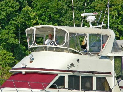
The big ticket item was a new bimini top and enclosure for the fly bridge. Our bimini was very mildewed and was nearing the end of its useful life. The plastic window enclosures were way past their useful life and we are thrilled to have new windows we can see out of. This project was not much work on our part as it is beyond the scope of my sewing abilities or interests, all we had to do for this one was write a check.

The old top was cream colored and showed dirt and mildew very easily, this time we opted to go darker. Burgundy would have been nice, but with the sun beating down dark colors are very hot so we compromised and used beige Sunbrella with burgundy trim. We like the look but have already discovered that it is indeed hotter than the cream was, the good news is that the dirt does not show as easily.

Thursday, November 13, 2008

Those Majestic Tows

Cruising on the rivers we encounter a lot of tows. When we were still sailing on the river we always referred to them as barges, as in "do you see that barge coming". But the truth is that the towboat pushes individual barges, usually more than one and generally as many as 15 lashed together 3 across and 5 deep; the entire assembly is referred to as a "tow". The 15 barge tow that I mentioned is the norm on the Upper Mississippi but on the lower Mississippi (below Cairo, IL) a towboat may push as many as 40 barges. On the rivers that we have traveled on there is no "towing" involved but in the Chesapeake and the Gulf of Mexico we have observed barges being towed.
Whatever you choose to call them I think they are one of the most majestic sights we encounter on the waterway. You may not call them beautiful but they are awesome in their quiet power. Plying the waterways 24/7 they operate in all extremes of weather.
A tow boat Captain has the tow strung out in front of him about 1/4 mile (on a standard 15 barge tow) and he has to maneuver it around corners and into locks and docks and loading facilities. All of the propulsion for forward movement and maneuvering is on the towboat, the barges themselves have no propulsion. Just imagine trying to maneuver into a lock that is only a few feet wider than your 3 lead barges. Now imagine doing it in the dark, in the rain (or snow or fog), yikes! These guys are very skilled and they are also generally helpful to pleasure boaters, or RVs (recreational vessels) as they sometimes refer to us.

Barge transportation is incredibly efficient. Each barge can carry 1,500 Tons, or 52,500 Bushels or 453,600 Gallons. The capacity of a single barge is 15 times greater than one rail car and 60 times greater than one semi trailer.

Generally speaking towboats are kept clean and freshly painted. When the crew does not have deck duties they utilize the time to see to scrubbing or painting the towboat, it is a huge floating billboard for the corporation that owns it.


We have had the opportunity to lock through with tows on several occasions. The first time we were apprehensive because we had heard stories but our experience was that the tow Captain was very courteous and also very conscious of our safety and comfort as well as the safety of our boat.


Wednesday, November 12, 2008

Down the Big Rivers

There are a lot of "big" rivers in this Country but I am referring to two of the largest, the Mississippi and Ohio. Native Americans called the Mississippi the Father of the Waters and Ohio was from an Iroquois word meaning "Great River".


We left Portage Des Sioux just after a flood and while the waters had receded and most of the floating debris had run off we still needed to be alert. As you can see from this shot taken as we were entering Mel Price Lock at Alton, Illinois not all of the "junk" was gone. Actually it had sort of "coalesced" here where the water is slack above the lock. We try to shift out of gear so that the props are not spinning and sort of glide through the logs before we re-engage the props.
Our traveling companions "Mojo" and "Telegraph Hill" exiting Mel Price Lock. Bill & Donna on "Telegraph Hill" are friends from Sioux Harbor who have decided to travel down with us.


The waves on the water between the bow of "Lauren Grace" and the island in the distance are caused by the flow of the Missouri River into the Mississippi. This is the confluence of the "Big Muddy", as the Missouri is called, and Mississippi. The water color is usually markedly different but not so much today due to the recent flooding. The current really picks up from this point due to the fast current of the free flowing Missouri and that is why you see the waves.


This canal leads the way to the final lock on the Mississippi. Occasionally boats miss this sign and follow the old riverbed, which leads them to a treacherous rocky area. In fairness to the boaters I must say that the charts are not clear at this junction, but the sign is large. Once through Lock 27 and out of the canal the Mississippi is open river with no controlling dams all the way to New Orleans.


Only a few miles downstream from Lock 27 is the city of St. Louis. The large stern wheeler in the foreground is the "American Queen" the biggest stern wheeler ever built; she was launched in 1995 when she joined the "Delta Queen" and the "Mississippi Queen" plying the rivers and carrying passengers wanting to re-live the luxury days of riverboat travel. Many times we have seen these boats on the waters, at night they sparkle like crystal palaces and when they go through a lock they give a steam calliope concert. This was the custom when a riverboat called at a town back in the day, if we are near the lock we always hang out to hear the concert. In recent years river travel has fallen on hard times and the boats were sold several times. The "Delta Queen" has likely taken her last voyage but the fate of the much newer American and Mississippi Queens is unknown.


A bit of the St. Louis skyline


The old PET Incorporated headquarters building. Larry worked here for many years before PET was acquired by another company and the headquarters closed. The sign on the top says "Apartments for Lease"


The structure with the arches in the foreground is part of the supports for famous Eads Bridge, an engineering marvel in its day. Completed in 1874 the bridge was innovative for a number of reasons, not the least of which is it was the first bridge to use steel as a primary structural material. The cassions used to provide a water tight space to pour the piers remain among the deepest ever sunk.


The gleaming Gateway Arch framing the historic Old Courthouse


The "Arch" as locals call it, designed by Eero Saarinen, was the winning design for a monument to symbolize St. Louis' role as the Gateway to the West . The competition was initiated shortly after WWII to solicit designs for a monument to be built on the grounds of the Jefferson National Expansion Memorial National Historic Site (now you know why they just say "the Arch") which was established in 1935 by President Roosevelt to memorialize Thomas Jefferson's role in the territorial expansion of our Nation.


Construction on the 630' tall by 630' wide monument, the largest in the Country, was begun in 1959 and completed in 1965. It was built from both sides and the last piece was the "key" that joined the two legs

Just downstream from the arch a few miles is Jefferson Barracks National Cemetery which overlooks the Mississippi and is barely visible through the trees


We pass under the JB (Jefferson Barracks) Bridge and St. Louis is behind us.


I mentioned that the current really picked up at the confluence with the Missouri and that we are below the last controlling dam on the Mississippi and that we are going down stream following the tail end of a flood. All of these factors made our travel on the Mississippi below somewhat challenging.


The current was unusually fast, the marks (buoys) were often missing or unreliable because they had been moved out of place, and there was still some debris in the water. This next series of photos shows one of the hazards that boaters traveling at that time started calling "diving buoys". These shots were taken in a 30 second span of time so you can see that we had to be constantly alert.


In this shot you see no buoys, just "funny" riffles on the water.


Here we are a bit closer to the "riffles"


Then we see the reason for those "riffles", steel buoys riding just below the surface are popping up.


Now they are rising higher out of the water


In a flash they start diving back down as pressure against them intensifies.


There you saw it, now you don't!. Remember this entire sequence happened in only 30 seconds.


Let me explain that buoys are anchored into the river bottom and a cable is attached between the anchor and the buoy, the cable has a finite length which is designed to allow for the appropriate water depth plus a little extra. During the flooding the current below St. Louis was running at probably something close to 9 mph; if a 60 ft long tree being pushed by 9 mph current snags a buoy it moves. Now it is in the wrong place or maybe it becomes hung up on something underwater further down the line after the original tree is long gone. When the buoy (and its anchor) is in water too deep or has something underwater pushing against the cable it is submerged, but because it is buoyant it struggles to rise to the surface when the pressure against the cable is slacked even a little. The current alone provides a lot of pressure and if the current is pushing a tree limb or other submerged item it can make the buoy dive underwater and then struggle to resurface. We watch for unusual disturbance on the surface and try to give anything that looks "funny" a wide berth. We were lucky, some others were not and incurred damage to their props and shafts from some of these buoys.


The confluence of the Ohio and Mississippi. You can see the incredible difference in the water color here, the Mississippi water is the brown color. At the far right in the photo is the bow of a barge just shoving out of the Ohio and into the Mississippi. Today the Ohio was placid and her 2 knot or so of current (on our nose) was a welcome relief after the previous couple of days.


Another confluence, this is where the Cumberland flows into the Ohio.


Following a tow as we turn up the Cumberland River