Wednesday, June 25, 2014

From Little Washington to Elizabeth City

Upon departing Washington, NC we made our way to Elizabeth City, NC via the ICW.  There is something I have been meaning to share with you about the Intercoastal Waterway and now, as we near the end of this waterway for a while, seems like a good time explain a little about it.  Those of you who are boaters might want to skip the rest of this post because you already know this stuff.

First of all it is not actually a waterway in the way that you may be thinking.  The ICW is really a series of connected river, creeks, bays, sounds, and sometimes man-made canals through which a course can be plotted that allows a boat to stay in protected waters as opposed to the open sea. 
Protected is a relative term.  If it is very windy the Atlantic or the Gulf of Mexico will have the highest wind speeds (because there is no land mass to stop or slow the winds), and thus the waves will be higher.  Also at a coastline the waves pile up and so the water is rough.  Thus most boaters, at least those in our size and type of boat prefer to remain in the ICW. 

This is where the relativity comes into play.  Generally the man-made cuts and the smaller rivers remain calm in all but the strongest storms, and if the forecast is that stormy we stay in port. In the bays and sounds however it can get rough.  In fact the worst whooping we ever got was on smallish (as opposed to a large Bay) Choctawhatchee Bay along the Florida Gulf coast near Destin.  Bays and Sounds are larger and wider bodies of water that are generally open to the sea on at least one end.  Thus a strong wind, coupled with their often shallow depth will kick up some fairly tall waves rather quickly.  This is especially true if the wind is blowing opposite of the way the tide is flowing.

But I digress - back to the ICW.  The various rivers, creeks, man-made cuts, and bays/sounds connect to each other and together, as a composite, they are called the Intercoastal Waterway.  For example when we left Washington, NC we followed the ICW to Elizabeth City, NC.  In order to do this we traveled down the Pamlico River to the Pungo River; then through the man-made Pungo-Alligator Canal to the Alligator River.  The Alligator River empties into Albermarle Sound which we traveled across in order to reach the Pasquotank River leading to Elizabeth City and the Dismal Swamp Canal.  From Elizabeth City we will travel the Pasquotank R. to the Dismal Swamp Canal to the Elizabeth River into Portsmouth/Norfolk where the Atlantic Intercoastal Waterway terminates and boats enter Chesapeake Bay.  I hope this wordy epistle clarifies, somewhat, exactly what I mean when I mention the ICW.  Then again it could be just too much information.

Albermarle Sound is know as a generally snotty body of water and most boaters give it a lot of respect.  In other words if it is windy stay off of Albermarle.  Fortunately we have always chosen well and have not had a really bad ride across - but it is generally either a rolly or a choppy ride.  In four trips across I have never seen it calm, this trip it was rolly.  It is about 20 miles from the protection afforded by the Alligator, until we are far enough up the Pasquotank to be protected from the west or southwest.  While it isn't far it takes up about two and a half hours to travel this distance.

Before we cross Albermarle we generally stop for the night in the Alligator River Marina run by Miss Wanda.  This conveniently located marina, right at the mouth of the Alligator River, is in the middle of nowhere.  It is a combination marina/gas station where people can fuel as they travel to the Outer Banks by car.  Stopping in this location allows us to get an early start across the sound the next day before the wind builds.  It also gives us a chance for a mighty fine fried chicken dinner.  Miss Wanda, who also doubles as the waitress, is quick to tell you when you check in that they "close at eight, so if you want to eat be here no later than 7:00".  We were there at 6:30 (just in case) and the chicken did not disappoint! 

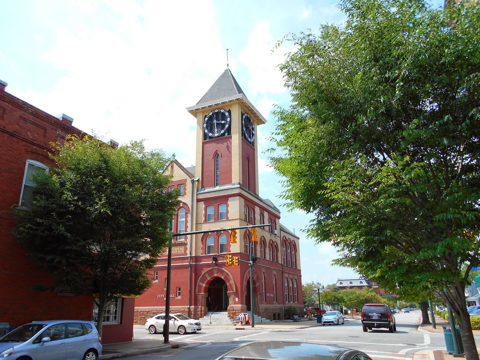
Elizabeth City is one of our favorite stops.  They are known among cruisers as "The Harbor of Hospitality".  In 1983 the city built Mariner's Wharf along their waterfront.  This complimentary dockage for traveling boaters was funded with contributions from businesses and individuals interested in reviving the downtown area by drawing visiting boaters to stop there.  In the fall of that year two retired gentlemen, Fred Fearing and Joe Kramer,  were hanging out on the docks to welcome the visiting mariners and Fred decided to clip some roses from his wife's garden and give to ladies on the boats.  The concept took off and "The Rose Buddies" were born.  For many years Fred & Joe greeted boats and helped them tie off.  When Joe passed on his rose bushes were transplanted to the wharf and Fred still greeted boaters every afternoon with a rose for the Admirals..  We were lucky enough to meet Fred Fearing on our first trip through the area in the spring of 2007 and were treated to one of his legendary wine & cheese parties.  Unfortunately Fred passed on in the fall of that year.  Today Gus has replaced Fred and he continues the tradition of helping boaters get settled and tells them about his community - but you have to cut your own rose.  Over the years Elizabeth City has added restroom and shower facilities, and if you know where to look (or if you ask Gus), there is even a source for water for filling your tank.

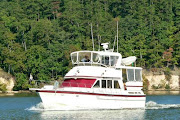
The rose bushes are just beyond the foreground of this photo

We were docked right where this blue boat is.
Step off the stern and smell the roses!
Downtown offers a Farmer's Market in season as well as the Museum of the Albermarle and a selection of restaurants and the atmosphere is delightful.  Many cruisers make this a "must" stop each time they cruise by.

Saturday, June 21, 2014

From New Bern on to Washington

In addition to the quirky musings Larry had about New Bern we spent an enjoyable few days walking the streets of the historic town, the second oldest town in NC.  They do a fantastic job of sharing their history; with interpreters at the replicated Tryon Palace and at the historic Stanley home.  Everything is made easy by the staff at the North Carolina History Museum.

Tryon Palace, not so much a palace as the colonial governor's home and the seat of colonial government in the North Carolina Colony, was constructed in 1770.  After the American Revolution it served as the first Capitol of North Carolina.  The Palace burned in 1798 however the foundation and the stables remained.  In the twentieth century the original plans and drawings were discovered and eventually the structure was reconstructed.  While not a palace it certainly must have seemed palatial to the colonists of that time.  In the photo below the Palace is the building the center, the original stable building is on the right side of the frame, and the kitchen building is on the left of the frame. Behind these structures the grounds slope down to the Trent River.


Our timing was perfect, the North Carolina Symphony was playing a free concert on the back lawn of Tryon Palace the Sunday we were there.  We discovered this info while we were uptown that afternoon and met a local couple in the pharmacy where Pepsi Cola was originally formulated.  They were telling us about the community and then mentioned the free concert that evening.  The music and surroundings were simply fantastic and the weather was perfect for enjoying the outdoor venue.  While at the concert we met other locals and generally had a great time.

The back lawn of the Palace where we watched the concert

Soon enough it was time to move on and we once again picked up the Magenta Line on our chart and followed it to Oriental.  After a brief stop we had to decide whether to visit the outer banks and Okrakoke or the little town of Washington, NC.  Since the weather on Pamlico Sound was not so pretty we decided on Washington, sometimes called Little Washington so as not to confuse it with Washington D.C.. 

Founded in 1776, and the first city in  in America to be named for General Washington, Washington, NC is on the Pamlico River and has a beautiful riverfront, they offer boaters a free dock -with no power or water, or a full service dock.  Since it was hotter than blazes we choose to pay and have air conditioning!  The town is small and charming but unfortunately they do not do a very good job of sharing their history.  They do however have some good restaurants!

Larry's Musings on New Bern


Theresa and I have been visiting the town of New Bern, NC located on the banks of the Neuse and Trent rivers and, as always, I was curious where the name New Bern came from - I’m going to assume the rest of you are too. 

Well, a long time ago in around 1710 it (second oldest city in NC) the area was settled by Swiss, and Palatine German, immigrants who were fleeing religious intolerance in Europe. The new colonists named the settlement after Berne, the capital of Switzerland and hometown of their leader Baron Christoph Von Graffenried.   This is important because the history of the city of Berne, Switzerland begins with its founding by Berchtold V, Duke of Zähringen in 1191.  The duke vowed to name the city after the first animal he met on his first hunt, which turned out to be a bear.  Thus New Bern, NC is “The New Bear” 

 New Bern was developed on the site of a former Tuscarora Indian village and as a result there were less than ideal community relations between the settlers and other Tuscaroraan villages for a long period of time.  New Bern remained the seat of colonial government through the revolutionary war, and served for a time as the State Capitol in the early post revolutionary period.

 Industry and trade developed until the years of the Civil War.  It continued as a viable center for the manufacture and distribution of naval stores through the 1700 and 1800’s.  That’s nautical talk for tar, turpentine, pitch and other items of this nature that were important to the construction and maintenance of wooden ships.

 Northern forces occupied New Bern for a period of time during the War Between the States, and it was a site of free black encampments and hospitals’ for the northern forces. The town had little damage throughout the war thus survived with many historic building in place.
 
Barbour wood boat on Display at the NC History Center
Another business that thrived in New Bern was Barbour Boat Works building wood work boats starting in 1933.  Throughout WWII they built large and small wooden boats including mine sweepers.  I was not familiar with the small boats but they are very sought after and were considered a rival of Christ Craft at one time for design craftsmanship.   Some of them were powered by a marine version of the durable flat head Ford V-8.


“Brad’s Drink” a pure, delicious, wonderfully refreshing and bracing drink in hot weather.   Yes, we are talking about Pepsi-Cola founded in New Bern by Caleb Bradham in 1898.  The Original Pure Food Drink, Guaranteed under the U.S. Government Serial No. 3813. 

I always remember an advertising campaign from my youth:  “Nickel, Nickel, Nickel, Trickle, Trickle, Trickle, twelve full ounces!  BEWARE OF IMITATIONS!”

 Wait there’s more!  

The bear symbol, adopted by New Bern as the official mascot, was revitalized and updated on the 300th anniversary of the founding of New Bern, NC (1710 to 2110) in the form of artistic bear sculptures being sponsored by various organizations, businesses and individuals through the city.  These were very creative in appearance and naming, I have included a few.


“Mitchell Bear” with Theresa and me in front of the iconic Mitchell Hardware store
 
I hope you can see the olive on his nose!
 
 
“Sprit Bear” at the A B C store.  For those that don’t know the only place to buy liquor in many southern states is the ABC store


“Harvest Bear” at the Farmers Market


“Sailor Bear” by the recruiting station Veterans’ sponsored


“Barrister Bear” outside a law office


“Bear E. Essentials” by the Potash Corp. and many more.


Just one more item and my favorite.  It was manufactured by The Seth Thomas Clock Company, a No17 Gravity Escapement Tower Clock (like a grandfather clock).  It is probably a good thing our boat is not big enough to carry it, and besides they repeatedly turned down my offer of removal (I really want one)!  The clock contains two chambers with mechanisms; the upper housed and chimed the 800 lb bronze bell while the lower ran the Four Faced Clock with 9’ arms.  It was North Carolina’s first Four Face Clock and was originally installed in the US Post Office and Customs House (now City Hall) in 1911.  It served the community and welcomed visitors for 90 years by land and water.  It was taken out of service and removed from the tower in 2007 due to 90 years of wear.  Volunteers from The National Association of Watch and Clock Collectors and the New Bern Public Works began the removal and restoration of the clock to its former grandeur. It now occupies a place of honor in the North Carolina History Center near Tryon Palace. It has been restored to working order, although it only chimes a 30 lb partly muted bell (still very mellow inside a building).  The display is very interesting indeed.  The clock works is 39” deep, 72” high, and 68’ wide, and weighs in at 2800 lb.  It originally was purchased for $2,950.  The 800 lb bell and 9” clock hands and face are still used in the Four Face Clock Tower, but are now served by a newer clock mechanism.  If your travels take you to this area it’s worth the stop. 
"Larry's" clock in its new home

And its old home which now uses a newer clock
 
So now you know.

Southport to New Bern

Leaving Southport, NC we traveled up the Mighty Cape Fear River to the turn for Carolina Beach.  We were lucky to be blessed with a rising tide to provide a "push" as we navigated upstream because the ebb can result in some fairly strong current against boaters at the wrong time of day.  In fact we left quite early (for us) in order to take advantage of the tidal push. 

Along the stretch of the ICW from Carolina Beach to Swansboro there are about four bridges that have very specific opening times once per hour; some on the hour and some on the half-hour.  If boats arrive too early they mill around and wait - if they arrive too late, even by a minute, they wait nearly an hour.  Thus timing is critical.  Also there are few anchorages, actually only one, and almost no marinas along this stretch.  The anchorage is not to our liking, or at least Theresa doesn't much like it.  The bottom is soupy mud and the holding is poor, the wind often blows which makes for a sleepless night with poor holding.  Also the anchorage is in the Camp Lejeune Marine base and there are often night exercises going on which create noise, all in all not very restful. 

We were spared from having to anchor here by the kindness of others, yet again.  Our friends from RoyEl are originally from this area and they have a friend here with a dock he does not use.  Roy and Elvie called their buddy Ed and he kindly invited us to stop and use his dock.  Not only that but he was there to take our lines and he even cooked dinner for us.  We spent an evening sharing boating stories and life stories and now we have a new friend in Hampstead.  Thanks Ed!


Lauren Grace at Ed's dock in Hampstead
In the background is the Atlantic
In the past we have moved through North Carolina with venturing off of the Magenta Line that marks the path of the ICW on our charts.  This time we were interested in exploring a little so our plan was to skip a stop in Beaufort, which is nice but we have been there and done that, and spend some time in Historic New Bern.  This proved to be a great choice!

A PINK house on the way to Swansboro

Monday, June 9, 2014

OK, so I'm Lazy!

I am embarrassed because I have let so much time pass since my last posting here.  The truth is that I have had such good intentions - but, umm, well, you know what the pundits say about good intentions.

Since the last time we have traveled a good distance as we were just leaving Hilton Head and now we are about to enter Virginia.  I could argue that Hilton Head is at the very southern tip of So. Carolina and that North Carolina's coast is very long.  And while that is true, it is also true that I am just not disciplined about keeping up with posting here. 

We have been having too good a time to download the pics and sit at the computer.  We made a fairly quick trip through South Carolina because we were planning a visit to friends in Southport, NC and we didn't have a lot of time to piddle but still some nice anchorages were calling to us. 

After all the miles of sawgrass country the beautiful Waccamaw River is a delight.  If you are following on a map you will find the mouth of the Waccamaw empties into Winyah Bay just north of Georgetown, SC.  There are lots of moss shrouded trees along the river banks and many small creeks that beckon cruisers to stop and spend some relaxing time.  Thoroughfare creek is especially inviting to us and so we planned our time so that we could spend a couple of days there.  We were not disappointed.  There were no other boats anchored, a few fisherman passed by each day as well as a few local runabout just out for a slow cruise - other than that it was just us and the birds and the 'gators.  The weather was nearly perfect and we enjoyed just hanging out in the creek and reading, napping and watching the wild life.
Our quiet anchorage in Thoroughfare Creek


If you look closely you can see the 'gator in the grass along the shore
Cypress trees along the Waccamaw
You have likely noticed the dark color of the water, it is not dirty.  The brown color comes from the tannin in the cypress knees rather than from mud.  We follow this beautiful river from Georgetown nearly to Myrtle Beach and we savor every mile.  Actually we could stay here for weeks but we reluctantly moved on in order to have time to spend in the delightful town of Southport and with our friends there.

Pat & Bill Steele have made North Carolina their retirement destination and it is easy to see why.  Compared to St. Louis the climate is very mild; there is a lot of American History along the shores of NC, and the people are very friendly.  Pat had made arrangements for us to have a guided tour of Brunswick Towne, founded in 1726 on the banks of the mighty Cape Fear River.  It was, at one time, the home of the Royal Governor and a very important port for the shipping of naval stores back to England.  The historian who narrated our tour was so very knowlegable and we were even treated to a preview of some new artifacts that had just been uncovered and were still in the process of being dated.  What a great overview of the pre- revolutionary war history of NC.  Although abandoned completely after the revolution the ruins of Brunswick town became important to the Confederacy during the Civil War when officers decided that the site would shore up Confederate defenses of the important port of Wilmington further up the Cape Fear River.

Amid out history lessons and bird watching time in Southport we were able to find time for a much need trip to the grocery to provision for the next part of our trip.  When we entered the Wal-Mart store we each took a cart and went our separate ways.  Larry visited the automotive department in search of oil for the engines on the boat and I went to buy groceries.  We rendezvoused in the produce depart when Larry returned with his cart full of six gallons of oil and 3 cases of beer.  A gentleman who was shopping with his wife articulated the observation that we were boaters.  When Larry answered "well, yes we are, did you see us at the marina/", he replied no, he hadn't - but only boaters buy that much quantity of those two items together!


Tuesday, May 20, 2014

Larry's Musings


Did you know why South Carolina is called the Palmetto State?
This nickname refers to South Carolina's official State Tree, the Sabal Palmetto (Inodes Palmetto), commonly referred to as the Cabbage Palmetto.

The Palmetto is rooted in historical significance dating back to the Revolutionary War. On June 28, 1776, the British fleet's attack on Sullivan's Island, located in Charleston Harbor, was repulsed.  Under Colonel William Moultrie’s command the spongy Palmetto-log fort withstood the barrage of British cannons until the fleet retreated. 

The Sabal Palmetto Palm was added to the National Flag of South Carolina, after it seceded from the union in 1861 due to acts of northern aggression.  
 
One other small item before Lauren Grace crosses into waters of North Carolina. It evidently is a little known fact (even by most locals) that South Carolina was also known as “The Iodine State”.  Perhaps you are wondering why.   Well, I have researched it for you; it was due to the large percentages of iodine found in the vegetation growing in the state.
The chemical element iodine derives its name from the violet color of its gaseous form.  A rare element (sixty-second in global abundance), it occurs naturally as a trace chemical in certain soils, rocks, seawater, plants, and animals.  In humans, it is largely found in the thyroid gland, which secretes iodine-bearing hormones responsible for regulating metabolism.  A deficiency of iodine causes an unsightly swelling of the neck and jaw known as a goiter.  Not a good thing to have.
In the late 1920s, the South Carolina Natural Resources Commission began a public relations campaign to advertise the high iodine levels found in fruits, vegetables and milk products from the Iodine state.
Even low country moonshiners around Hell Hole Swamp jumped on the iodine bandwagon, advertising their brand of corn liquid with the slogan: “Not a Goiter in a Gallon”.  As I said before no one wants a Goiter.  So now you know


Sunday, May 18, 2014

To Hilton Head and Beyond

For us one of the advantages to being on this coast was being close enough to just pop by to visit with our friends in Hilton Head.  Many of you reading this will remember Kurt and Ann our dear friends who moved down to South Carolina almost fifteen years ago.  Leaving Savannah we were just a short day's travel from Hilton Head and we were excited to spend some time catching up before moving further north.  There is nothing quite like spending a perfect day with old friends and ending it watching the moonrise over the ocean.

Moonrise over the Atlantic

Sadly the time came to move on and we headed up to Beaufort for the evening.  Beaufort SC is one of our favorite stops, unfortunately this time we were only able to spend a day before moving on again.  What a fun day it was though.  As we pulled up to the dock we were greeted by a voice saying, "Is that Captain Larry driving that boat?" and we saw the smiling faces of Terry & Lola aboard Sunny Days that crossed the Gulf of Mexico with us.  The dockmaster was down on the dock to move a couple of boats to make room for us so of course there was some good natured kidding about if they should take our lines or not since, you know, they don't allow troublemakers here.  They determined that we had been "approved" and we enjoyed a nice evening visiting and learning where each other had been since Dunedin.  Thanks Lola and Terry!

Once again we were saved by the kindness of strangers.  We had walked about half a mile to Publix to get some coffee - which, of course, we had forgotten when we were doing provisioning in Hilton Head.  As we were starting back it started to rain, we weren't totally unprepared because we had the foresight to carry our slickers, but as we were crossing a side street a woman in the intersection rolled down her window and asked if we would like a ride to the marina.  A little surprised I replied, "sure if it isn't too much trouble", and, of course, it wasn't so we got a lift and by the time we were back (which was maybe two minutes) the rain had quit and we didn't even get wet carrying things down to the boat.  We continue to be blessed by meeting the nicest people.

The next day found us moving on again and that night we had our last anchorage in sawgrass country.  Tom Point Creek, about halfway between Beaufort and Charleston, is a favorite spot and it was just as pretty as it was the last time we were there seven years ago.  We like it because we often see a lot of dolphins there.  Back when we were fairly new at cruising a local fellow out for a evening boat ride with his little grandchildren told us that many porpoises come to this creek to give birth and then they raise their babies here and teach them how to feed by herding fish into a corner for them.  We didn't observe any feeding behavior this trip but it is still lovely there.  We didn't see another boat and thought we had the whole place to ourselves until we were leaving the next morning and saw a sailboat anchored a couple of turns closer to the waterway than the spot we like.

We only had a short distance to go after we left Tom Point Creek to get to a marina just outside of Charleston.  We didn't linger in Charleston though because we have friends expecting us in North Carolina and we still wanted a couple of days to anchor and hang out a bit further upstream.  The following morning found us motoring past the Battery as we moved through Charleston Harbor on our way to the ICW to continue north.  Normally we anchor the first night out of Charleston, but thunderstorms were forecast and that is a very open anchorage so we moved along as quickly as we could - with the help of a little 'push' from the tide.  We spent the night safely tied to a dock in Georgetown, SC (waiting for thunderstorms that never came) before we  headed up the beautiful Waccamaw River.   More about that next time.


Wednesday, May 7, 2014

Larry's Musings


I was recently asked why Isle of Hope was called Isle of Hope, and since I was there here's what I found

 Isle of Hope (L' Isle Desperance)

It is stated people have found refuge at L' Isle Desperance (Isle of Hope), which was an island at high tide and easily defended due to swamps, gators, snakes, bugs and other crawly, biting, stinging things.  Prior to1720’s the French are credited with some of the first colonization of this Isle. French Hugenauts who came here to escape religious persecution in predominately Catholic nations/states, mainly Europe at the time (the version I found).  

Supposedly many pirates buried their loot here, as well as took refuge from the Navies of the time. Whose Navy is your choice, as the Colonials and British early on referred to them as Privateers, but not the Spanish?  Must be lots of loot still out there as I can find no reference to it ever being found.

The English Occupation - In 1733, when General James Edward Ogelthorpe founded the Georgia colony a surveyor named Noble Jones was granted a tract on the island that was eventually named Wormsloe.  This was possibly after an English estate but more probably due to the mulberry trees that were grown there, the worms of which, it was hoped, would form the basis for a silk industry.  The Isle was defended from Indians, Pirates, Spanish, and I guess all other comers, up through the revolutionary war period. 

I never could find out what became of French Hugenauts escaping religious persecution.

So now you know all about early founding of Isle of Hope.  For us it was a nice laid back restful stop although it still has some crawly biting things.

Larry

Monday, May 5, 2014

Moving Through Georgia

 
 So when the “big storm” finally arrived with a whimper we left our safe little dock behind and continued north through the Georgia sawgrass.  What, you ask, is sawgrass.  Actually it is not a grass at all it is a sedge of the genus Cladium, which grows in profusion in wet and infertile soils.  In coastal Georgia (and much of South Carolina) there are very few trees along the rivers and salt marshes.  The marsh (or swamp, or wetlands, depending on your persuasion) supports the growth of the this grass-like plant.  The undergrowth of newer grass is green, but the top portion of the grass has a golden hue.  Through the sawgrass run ribbons of water, some of it’s navigable and some ribbons are just dead end creeks that may, or may not, be deep enough to anchor in.


Miles and miles of grass
 
 
The first trip we made up this way I did not enjoy it at all, I must admit ,however, that it has grown on me.  I will never like it as much as the wooded banks of the Tennessee River but it does have its own appeal.  The other thing about Georgia is that the many small rivers connect with the large sounds which provide access to the Atlantic.  It is not generally reliable or "good" ocean access due to the extremely strong currents and large tidal swings contributing to the shifting sands where the river meets the sea.  The ICW leads a boater through these sounds to the next river or creek to continue the journey north or south.  In the wrong kind of winds these generally shallow sounds can whip up significant waves fairly quickly - which is not, as you might guess, all that much fun.  In addition, at a couple of locations the route through the sound leads us nearly out to sea before we turn up the river.  If the tide and the wind are opposing each other this can lead to an “interesting” ride.  In some weather conditions a fog can roll in off of the sea and generally obscure our vision as we search for the navigation marks.  Generally we try to avoid moving in “ugly” conditions;  but even in good weather this is an area that commands our full respect and attention.
 
Beautiful golden hue in the afternoon sun
 
This time though the weather was nearly perfect, the tides were giving us a nice “push” for much of the way (as opposed to running against us and slowing us down).  We were happy to run 62 miles and anchor in a favorite creek that we found on our first trip through back in 2007.


Sawgrass as far as you can see from our anchorage
Only one other boat in our anchorage

We were treated to a beautiful sunset and a peaceful night.  In anchorages like this, away from the lights of most civilization, we see the most beautiful skies with so many stars it is unbelievable.


Sunset in sawgrass country

The following day we had an easy run into Isle of Hope Marina in the charming old community of Isle of Hope, just south of Savannah.  Our friends, Bill and Annie Griffin, were there and we were invited to celebrate Bill’s birthday with them at a baseball game.  We had box seats for the Savannah Sand Gnats against the Rome Braves.  We enjoyed some really good baseball – and the home team won!  Sandy even came to give the birthday boy a high-five.  Other friends arrived and we had a good time catching up with each other and on mutual friends that we each had seen recently.  The boating community is small enough that we share many friends and although we aren’t necessarily in the same ports at the same time it is easy to stay connected.

Sandy helping the birthday boy celebrate


Sunday, May 4, 2014

The Sawgrass Country


After leaving Jacksonville we passed through a low marshy area of the waterway to Fernandina Beach – the last miles of Florida.  North of Fernandina, which is the northern point of Amelia Island, we entered Georgia.
Generally the first stop we make in Georgia is Cumberland Island formerly property of the Thomas Carnegie family which built an incredible mansion there in 1882.  The island separates the Atlantic Ocean from the ICW and is a wonderful stop because it provides a safe anchorage, and sightseeing on the island, which is now a National Seashore, is spectacular.  But this time we didn’t stop for a number of reasons, the most important of which was that a friend of ours from our sailing days in St. Louis was up the coast about twenty-five miles at Jekyll Island and was only going to be there one night.  We hadn’t seen Barry in a few years and wanted to hurry along to say hello before he had to return home, and so we pressed on to Jekyll Harbor Marina.

Just beyond Cumberland we motored past the U.S. Navy’s Kings Bay Submarine base and were treated to the sight of two boats lying at the quay.  It is always a thrill for us to pass by a military installation and see our flag flying proudly.   We didn’t have much time to gawk however because the navigation marks change in this area and it requires our attention to make sure we remain on course.
In Georgia it is VERY important to remain on course because the waterway is often quite shallow and the tidal swing is significant, as much as 6-8’ in most locations.  We arrived at Jekyll at the max ebb tide which means that the current is running very fast; because we had to dock perpendicular to the current it was challenging but Larry handled it with his usual skill and even received compliments from the marina staff on his docking.  The plus benefit was that we got the last slip and it right next to our friend.  We had a great evening catching up on old times.

The second reason we felt compelled to hurry along was because bad weather was in the forecast.  After spending the night at Jekyll, also a stop worth a longer look, the forecast looked good for the first half of the day and we decided to move up another 20 miles or so.  Now normally we like to put in 50-60 miles a day, well to be honest I like to put in about that much – Larry will go for much more.  In Georgia, depending on the tide cycle, this becomes really important because the tidal swings are among the highest in the country, and certainly the most extreme for where we travel.  Add to that the fact that the ICW if very poorly maintained in this area and we often need the help of the high tide in order to have adequate depth in some areas.  Thus those twenty miles put us in a good position to get a run at a very shallow section and position ourselves to traverse it near high tide.

Anyway after a couple of hours we put in at another marina.  This is a first for us because on our past trips we have generally anchored in Georgia rather than paying marina fees for a one night stop.  This trip however, the weather has been in one of those cycles where it can’t decide.  After devastating Alabama and Arkansas the big storm that was forecast to hit us sort of stalled out and flooded the Gulf Coast before it moved on over to this coast.  Thus our stop at Hidden Harbor Club was for three days and not just one night.  Still, given the punch that this storm was packing we didn’t want to challenge it. 


View from the deck of Hidden Harbor Marina

 
Hidden Harbor is just north of Brunswick, GA and proved to be a delightful rural stop, just the kind of marina we like.  The floating docks were close to the clubhouse which had comfy rockers and overstuffed sofas as well as a television and fast Wi-Fi, so we were able to catch up on all of the video and you-tube of the storm damage in locations that we are oh so familiar with.  Including Lucy’s Branch Marina up on the Tennessee River, which was destroyed in a tornado, and the flooding in Fairhope, and Pensacola where we have friends.  Luckily, with the exception of the devastation at Lucy’s Branch, all of our friends fared OK - although some were without power.

By the time it finally got Brunswick the storm had pretty much wore itself out and rather than thunderstorms and north winds at 20-25 mph all we got was cooler air and a little drizzle.  But you never know and we try to err on the side of caution.  Part of what makes our lifestyle so much fun is that we don’t travel with much of a schedule and so it is easy to be flexible.  It is often when we do something we hadn’t anticipated that we meet the most interesting people and have the most fun.
 

Tuesday, April 29, 2014

This and That Before The Sawgrass

  When we left Palm Coast we moved on up the Waterway to the Jacksonville Area.  The City of Jacksonville maintains a free dock on Sister's Creek just north of the ICW's intersection with the St. John's River and we stopped there for the night.  I mean it is free, right.  We worried that there might not be room for us, we needn't have.  We arrived a little after 3:00 in the afternoon and the dock was empty.  Good and bad - good because there was room, bad because there was no one on the dock to take a line.  It was a floating dock, also good and bad - good because there is considerable tidal swing in this area, bad because there were no pilings to lasso and  the cleats were way down on the water.  The tide was falling, and falling fast which was pushing us away from the dock and the wind was also working to push us off.  In a situation like this Larry brings the boat to the dock and I have to sort of flip the rope (we boater's call it a line) around the cleat and hang on; actually when the current is very strong - and it was- I have to secure the line around a cleat on Lauren Grace so that he can use the power of the engines to move the boat closer to the dock.  I'm not going to give a play by play of the whole ugly scene but let's just say that it took all of the skill we have both developed in the past 8 years to get us close enough to get three lines on so that Larry could manage to jump to the dock and grab the final line and secure the first three.  Maybe it was free for a reason!  Still, it was a nearly new facility, in the perfect spot, with trash cans, and potable city water and it didn't cost a dime.

Last time I shared about the kindness of others but we just had kindness taken to a whole new level.  A couple of hours after we arrived at the free dock a local gentleman came by and paid a visit.  Capt. Browne Altman's business card describes him as "Self appointed, unofficial, Greeter".  He is in the business of "paying forward the kindness of others".  What a kind man he is, not only did he stop by to introduce himself and see if we needed a ride to anyplace or any advice about repair technicians in the local area he even brought gifts to all of the boats on the dock (by now three more had arrived).  He moved down the line of boats chatting with each one in turn, and he was just delightful.  An old sailor himself, he has lived in the area for many years and appears to enjoy meeting the boater's that come by, he is a great ambassador for his city.We were the fartherest boat from the parking
lot and by the time he got to us he realized that the last coaster set he had with him (he weaves them from colored nylon cordage) was missing two coasters.  He asked when we were leaving and promised to return with the missing coasters, of course we thanked him and said he needn't go to any trouble.  But sure enough, just after dark when we had gone inside and closed the doors to keep out the noseeums, we heard a "Hello" and Browne was back with the coasters!  What a special memento of our brief visit with this exceptional human being.

I always look for interesting boat names.  Along the way today I saw a boat docked in front of a house on the waterway bearing the name "Knot Enough" - do you suppose there may be another boat in their future?  Another good name today was a boat that came into the dock shortly after we did, named "Mach Turtle", that one amused me as the perfect name for a slow boat.

And, as always, I looked at the homes.  I snapped a few of the more interesting examples
 
This one is quite modest but the umbrella is a nice touch.


Understated - on a "corner lot"


This one looks as though they just couldn't settle on a style.


Or a color, or an exterior finish material, or any landscaping... 


          And Finally a shot of a dry dock along the St. John's


Sunday, April 27, 2014

The Kindness of Friends

Before I get to the topic of this post I have to respond to a couple of e-mail queries and report on the Iguana Oil insect repellent.  In a word it was the proverbial "snake oil".  Both of us have used it and applied it liberally before going out; both of us have about a million noseeum bites.  So no, it didn't work as advertised....perhaps if our body chemistry was different it might, but then they might not bite us anyway!

After we left Cocoa we stayed the night in the most delightful anchorage that gave us a fabulous view of the Ponce inlet just below Daytona.  We had read about this spot the last time we were on this coast and didn't stop, this time we asked a cruiser we met in Cocoa about it and after hearing first hand what a nice spot it  it was we decided to drop our hook for the night.  What a great anchorage!  We were the first boat to arrive that evening and so we had our pick of spots, and we picked poorly.  We like to anchor in 8-10 feet of water so that we don't need to lay as much chain as in deeper water (don't ask, it's just more boaty stuff and the explanation would bore you non-boaters out there).  So we picked a spot and settled in, I had my sunglasses off and was squinting when we dropped the hook.  Then after we were settled and Larry came back to the bridge I had put my glasses back on and could see a patch of paler colored water just ahead of us (aah yes,  the benefits of polarized sunglasses).  About the same time I realized that we were at high tide and it had not yet begun to ebb.   Our spot wasn't as good as we thought. The short explanation is that when the tide changed our boat would swing into that patch of shallow water and the water would drop about three feet.  We reevaluated and decided to haul up the anchor and move fifty feet the other direction, it was a pain but an hour later when the tide turned we were so glad we had.  We were especially glad when we watched a little fishing boat ground on the sand and pole themselves off!

We are now in Palm Coast, it was a stop we enjoyed a few years back and we found it just as delightful this trip.  The marina here is small and friendly, just our cup of tea.  And they remembered us and even asked after Lauren, who was a toddler the last time we were here. Naturally that places them on the "A-List". 

I have mentioned before that we belong to several boating organizations, one of those is MTOA (Marine Trawler Owners Assn.), and we knew they have a number of members in this area.  Since we were in need of a big grocery shopping trip we called the local Port Captain, Phil Lowe and his wife Sarah.  They could not have been more gracious in bringing us a car to use, inviting us to join them for dinner at the Elk's Club, and taking me to get a haircut.  By the time we had all of our chores done it was Friday, when Phil offered to find us a free dock if we wanted to avoid the weekend on the water and save a couple of days of marina fees we quickly accepted.  Once again it is the people we meet along the way that make our lifestyle so enjoyable and so special.  

Tomorrow we will leave for Fernandina Beach, then Georgia.  Much of our next week will be determined by the weather, even more so than usual.  Georgia boating is a story that deserves a posting or two so stay tuned for more on that subject.

Shots of our weekend view as seen from our sundeck

In addition to lovely homes we were treated to dolphins feeding


This is where the dolphins were feeding